

Drone Photography Colorado - Roger Williams Photographer
If you are searching for aerial drone photography Colorado then you have found the right page. I am a fully insured, FAA-Certified (Part 107) drone pilot and photographer. My availability includes Colorado, North America and worldwide. I offer aerial imagery for residential and commercial real estate, marketing, inspection and mapping.
Residential Real Estate
The Collection- - 20 High resolution aerial photos
- - 5 HD video clips
- - 30 second branded promo video, captions, contact info and music
Commercial Real Estate
Marketing Package- - 20 High resolution aerial photos
- - 5 HD video clips
- - 60 second branded promo video, captions, contact info and music
Sell real estate faster!
Homes with aerial images sell 68% faster vs. homes with standard photos (MLS Study)
Next-day turnaround!
I will have your high quality aerial photos or interactive 2D/3D maps ready in 24 hours
Save time & money!
Topographic data gathering with a drone is 400% faster than ground-based methods
Drone photography Colorado mapping:
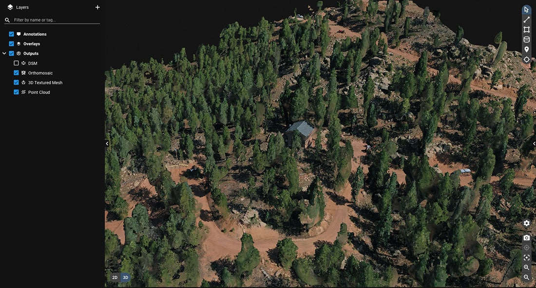
Orthomosiac 2D & 3D aerial mapping
Drones give you a full image of the entire location, which is ideal for mapping and surveying applications. Moreover, drone photography is affordable compared to alternative aerial platforms.
How it works
My aerial platform generates high definition 2D maps and 3D digital models. This type of imagery is known as orthomosiac mapping.
Firstly, the process begins by taking several overlapping photos of a particular area. After the imaging flight(s) are complete, I process the images using photogrammetry software. Finally, the geo-corrected images are audited for quality control and compiled into a digital orthomosiac map.
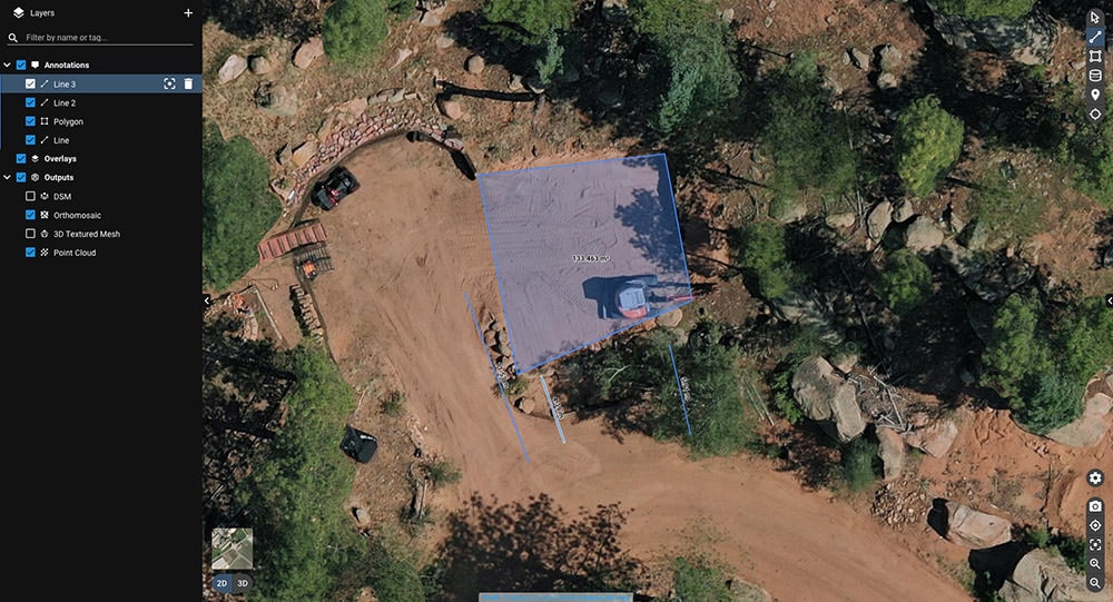
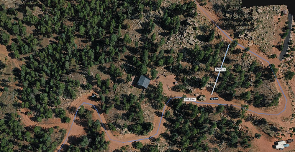
Use cases & deliverables
My clients typically use this type of imagery to plan construction projects or assess various issues such as recent storm damage, erosion, and more. Your deliverable is an entirely digital interface that allows you to view your maps at your convenience. It also provides seamless switching between 2D and 3D, as well as accurate measuring tools for distance, area, and volume.
Aerial Mapping
Surveying & Insurance- - Up to 4 hours onsite for precision image acquisition
- - Precision image processing
- - Delivery of Orthomosiac mapping interface - allows for multiple viewing angles & accurate measurement
- - Geo-tagged high resolution aerial photos
- - Great for surveyors, engineers, and insurance assessors